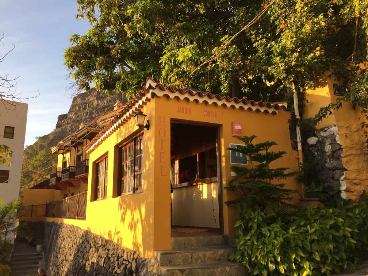
Stage 1: accommodation

Hotel Jardin Concha

The Hotel Jardín Concha is a small, friendly hotel with simply but neatly furnished and always very clean rooms (Link: Hotel Jardin Concha). Perfect for hikers: Located almost directly on the GR-132 in the district of "La Calera" and plenty of space on the balconies and terraces to relax or dry laundry.

There is a very tasty breakfast here, which can be taken on the roof terrace in good weather.

There is a wide range of other accommodation options in Valle Gran Rey. From small pensions to 4-star hotels, everything is represented. When booking accommodation, however, you should pay close attention to the location: The municipality of "Valle Gran Rey" consists of several districts, some of which are several kilometers apart. The district "Las Hayas" (destination of stage 2) also belongs to the municipality of Valle Gran Rey, but is over 1000 meters higher than La Calera! For stage 1, the districts of La Playa, La Calera or the easily accessible accommodation Hotel Gran Rey (3 stars, higher proportion of package travelers, link:  Hotel Gran Rey) or the Apartamentos Charco del Conde (apartment complex with simple but spacious rooms, pool, beach location, link: Apartments Charco del Conde).

For booking accommodation we recommend: our tabular planning aid.

Option: Two nights in Valle Gran Rey

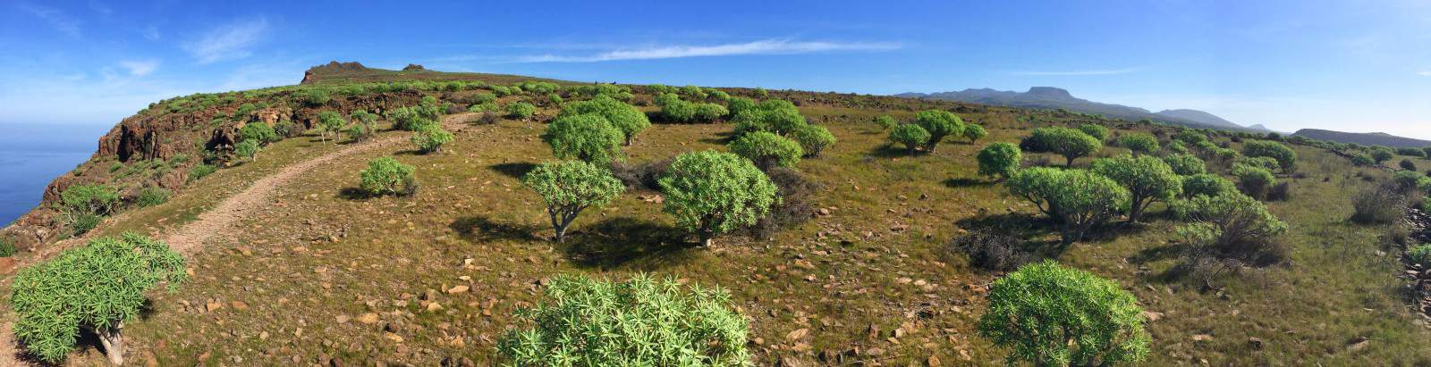
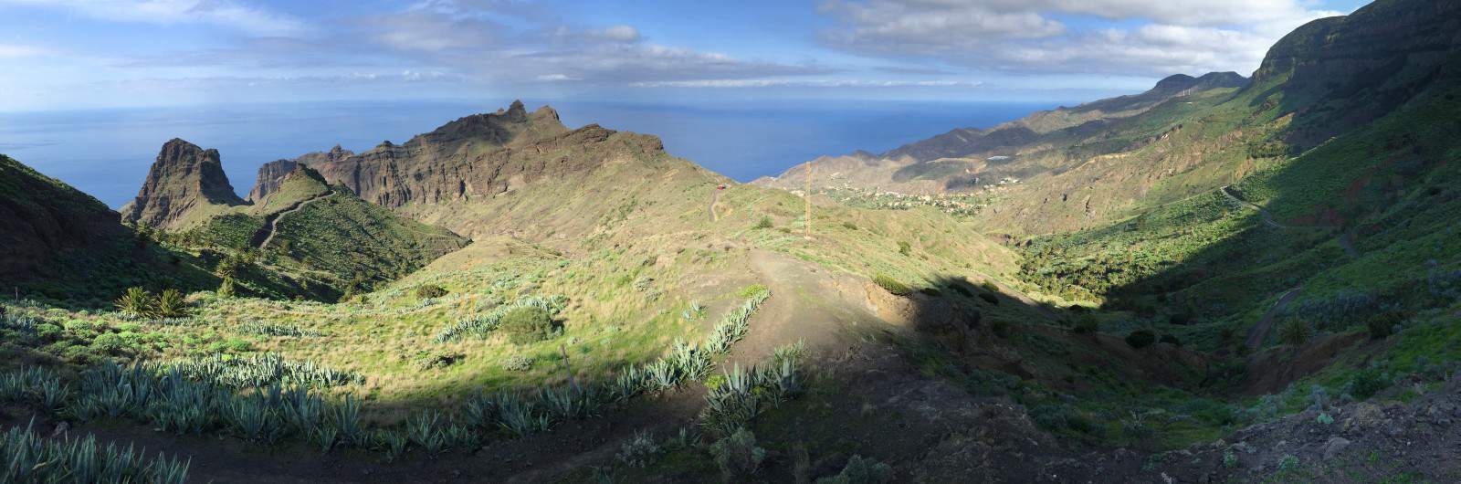
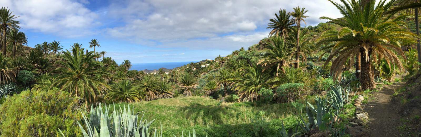
If you want to take the circular hike on La Gomera slowly and have some time, it might be worth spending two nights in Valle Gran Rey. It is not for nothing that this part of La Gomera is the most popular holiday region on the island, numerous cafés and restaurants and a bit of hippie flair make your stay very pleasant and relaxed.

Tips for daytime activities in Valle Gran Rey:

  • Bathing in the Atlantic: One of the most beautiful natural beaches of La Gomera is located at the southwest end of Valle Gran Rey behind the district "Playa de la Calera".
  • Short hike to the waterfall at "El Guro": A very popular and family-friendly hike leads to the waterfall near the artist's village "El Guro", which is well worth seeing.
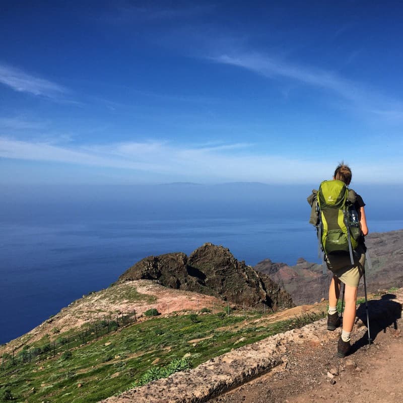
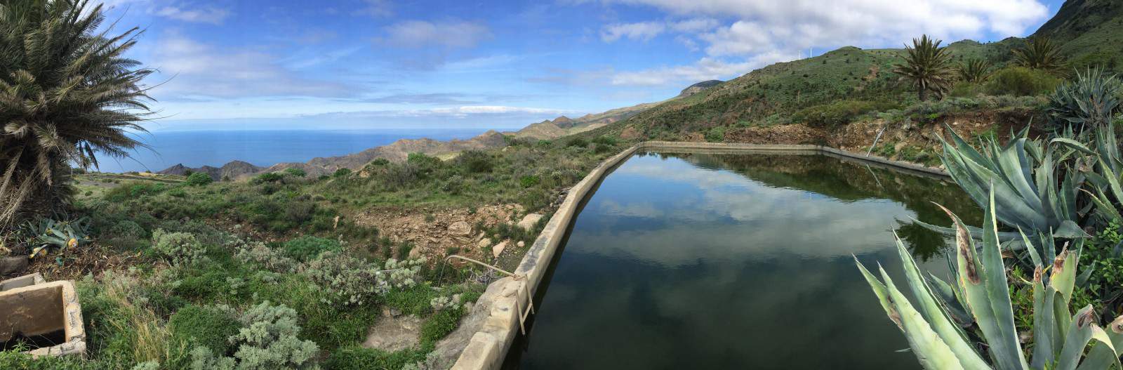
  • demanding day hike through the rocky gorge "Barranco de Argaga"The hike described here The first part leads up through a spectacular rocky gorge, but the second part is identical to the descent into Valle Gran Rey from our stage 1. If you want, you can instead extend the hike to El Cercado or Chipude and from there take the bus back to the Valle Drive Gran Rey (currently daily except Sundays with line 1, Note the bus timetable).

The natural beach "Playa del Inglés" is one of the most beautiful on the island

Stage 2: map

Stage 2: Directions

  • grandiose view on the ascent from the Valle Gran Rey
    grandiose view on the ascent from the Valle Gran Rey

Directions/Route

Our second hiking day begins in the district of "La Calera". We hike up through the narrow streets in the village until we reach the antenna mast directly above the village (waypoint 1). From here, the path leads us over four stone steps to a signpost, where we meet the officially designated path GR-132 (waypoint 2), which leads up here from the main road. If you didn't stay in "La Calera" but further up the valley, you can get on from there.
The ascent that follows is arduous and worthwhile at the same time: it offers an unbelievable panorama of the green river delta of Valle Gran Rey, the deep blue sea and the mighty rocks of the island. Accordingly, this hiking route is well frequented. After about 1:45 we reach the viewpoint "Riscos de La Mérica" (waypoint 3), which can be recognized by a single tree and can be reached at the end of the ascent in a short, comparatively flat section. At the edge of the rock massif we have a view of both valleys: the Valle Gran Rey and the adjacent gorge with its ocher and reddish rock tones.

We leave the vantage point past the tree in a northerly direction and the path becomes much more lonely. We hike for some time along the western edge of a plateau covered with bushes and towards two flat rocky outcrops. The path leads between these two and joins the slightly wider path that ran along the eastern edge of the plateau (waypoint 4). From here we have a view back to Valle Gran Rey and large parts of the route that we covered in stage 1.
We follow the path along the ridge and always get great views to the left and right: with good visibility we can see the neighboring island of "La Palma" with its two elevations on the horizon. The views of the uninhabited side valleys towards the sea and the valley of Taguluche are also very spectacular.

In the distance we can already see the white houses of Arure, which we reach about 3:00 a.m. from the start. At the first houses of Arure we enter a paved road. After a left turn, the GR-132 branches off in the direction of "Alojera" and leads under an archway (waypoint 5). Here we will start again tomorrow in the GR-132. Today, on the other hand, we decide to spend the night in "Las Hayas", which is a little off the GR-132 path and accept a small detour, so we continue to follow the paved road to the center of Arure. Here you can take a break in one of the two restaurants in town. The restaurant "El Jape" (waypoint 6) is very popular with hikers, which becomes visible when hiking into the village on the opposite side of the gorge (recognizable by the parking lot in front of it or by the "Tienda del vino" written in large letters right next to it). The operators of the restaurant "El Jape" rent two small holiday apartments called "Rural Gomera" in town - sometimes on a daily basis (Link: Rural Gomera). One of them is set back from the road directly to the right of the restaurant, the other about 300 m from the restaurant (Location on Google Maps).

The island bus line no. 1 also stops right in front of the restaurant "El Jape" - so there is a direct connection to San Sebastián or back down to Valle Gran Rey. If you want, you can use this point to start the circular hike (start with stage 3) or to get off.

Stage 2 facts

Altitude: 950m ascent / 100m descent
Route: 11km
Duration: 4:30h (without breaks)

Route download - Stage 2 (GPX file)

All other downloads can be found at maps.

On stage 2 - view to the neighboring island of La Palma

From Arure to Las Hayas

From Arure, several paths lead to "Las Hayas", each of which is well signposted. So it's quite possible that you get lost in the signposts and get to "Las Hayas" on a different route than the one described here. That's not bad: tomorrow we'll have the opportunity to try another way back to get back to the GR-132 entry point.
Our way to "Las Hayas": From the restaurant "El Jape" we walk back along the main road and branch off to the chapel "Ermita Virgen de la Salud". The destination of today's stage "Las Hayas" is already written here. Behind the small chapel, the path leads past a house with bright blue railings and a small dam. The path climbs leisurely and we cross the road several times. When we pass beehives and through fenced plots of land on a small hill we come to an asphalt road again, we turn left there along the chain link fence in the direction of a small radio tower (waypoint 7, we ignore the other signposts to "Las Hayas". this place).
The paved road soon becomes a field path and there are views of the gently rolling landscape to the left and right - a stark contrast to the terrain that we hiked through this morning! In a pine forest it goes downhill for a short while. There a path branches off to the left back to "Arure" (waypoint 8). This one will take us back there tomorrow. But today we continue straight ahead until the first houses of "Las Hayas" appear and shortly afterwards we meet the main street. From there we continue uphill to the center of the small town.

variants and abbreviations

Bus line 1 crosses the hiking route of stage 2 at several points and therefore enables various variants and shortcuts:

Arure: The bus stops right in front of the "El Jape" restaurant. From here you can return to "Valle Gran Rey" or to "San Sebanstián" if necessary. In addition, you can of course also take a taxi back to the "Valle Gran Rey" and share the taxi with other hikers if necessary. There are also a few accommodations in Arure, so with a bit of luck you can save yourself the "detour" to Las Hayas and thus shorten both stage 2 and stage 3 by an hour each.

Las Hayas: The place "Las Hayas" is only one bus stop away from Arure on line 1 and thus offers the same connection options.

Stage 2: accommodation

The Pension Jardin las Hayas consists of a main building in the center of town and the apartments, which are a few minutes' walk away (Link: Jardin read Hayas).
In the main building - the "Casa Efigenia" - is the reception and the vegetarian restaurant. The guest room is more reminiscent of a somewhat outdated youth hostel or mountain hut, but the kitchen is genuine, guaranteed without preservatives or flavor enhancers and also very cheap (menu approx. 10 €).

Other than the restaurant, the apartments and rooms are up to date, clean, well-kept and comfortable!
Located in a small garden, apartments, terraces and rooms alternate with each other. After a strenuous day of hiking, you can enjoy the evening sun here on beautiful garden furniture!

In Las Hayas there are other accommodations at booking.com. When choosing accommodation, however, pay close attention to the location: "Las Hayas" is not an independent place with just over 100 inhabitants, but belongs to the municipality of "Valle Gran Rey" as well as the districts "La Playa" or "La Calera", which are directly at sea level " (goal of stage 1).

When booking accommodation, we also recommend: our tAbellar planning aid.

Alternative: "Rural Gomera" in Arure

The restaurant operators of the "El Jape" restaurant also rent two small apartments in the village under the name "Rural Gomera" (Link: Rural Gomera). The apartments are simple but very clean and offer very good value for money. The slightly shorter route speaks for an overnight stay in Arure (Las Hayas is not directly on the GR-132): The time saved in this way can be used, for example, by starting stage 2 in the afternoon and enjoying the amenities of Valle Gran Rey in the morning (Swimming at the natural beach "Playa del Ingles").

Stage 3: map

Stage 3: Directions

Directions/Route

We leave "Las Hayas" on the street marked "Camino Los Callejones" (identical to the way there yesterday). After approx. 1 km (waypoint 1) we turn right in the direction of Arure (from here, according to the signpost, 2.4 km). Shortly thereafter we come across a signpost on which today's destination "Vallehermoso" is written 9.2 km to the right. This variant would take us directly there, but we would miss out on some of the views. So we ignore this junction and follow the path to the left to Arure.

At a reservoir we meet the village of Aracadece and there the main road that leads down to Arure. Our hiking trail runs just below and parallel to the main road, in sections also directly on this and without continuous signage. If you want to make it easy for yourself, just stay on the main road for the short distance to Arure.
In Arure there is the possibility to replenish your provisions or at least the water supply (bakery, bar/restaurant).

In the first bend we leave the main road and find ourselves back on the path from yesterday. At the archway we turn right and get to the "Ermita del Santo". From here we are back on the GR-132, which leads directly behind the small church into a spectacular high-altitude trail. In the next hour we will enjoy the great views of the valley of Taguluche again and again and admire the route along the steep rock faces with fascination.

Little by little we descend in the direction of Alojera and after about 3 hours of hiking we reach this small town with its many green palm trees in time for a lunch break. At the first houses we first keep going downhill, but then turn sharply to the right shortly before the small church and walk uphill again for a short distance. The simple but well-frequented "Perdomo" bar, which has a sun terrace behind the building and offers freshly made rolls, is ideal for lunch breaks.

Tip: a short distance behind the bar is the biscuit bakery "El Masapé" - what is tastier than a few typical La Gomera biscuits straight from the oven?

We follow the road a few hundred meters further uphill, until after a few switchbacks the hiking trail leaves the road again.

Facts about stage 3

Altitude: 730m ascent / 1550m descent
Route: 16.7km
Duration: 6:45h (without breaks)

Route download - Stage 3 (GPX file)

All other downloads can be found at maps.

On the ascent we pass numerous water basins and the hiking trail repeatedly touches the serpentines of the road.
After a crest we go downhill for a short while and cross the road diagonally. Shortly thereafter it goes very steeply uphill again. In part, the steep path in this section is beautifully paved and provided with steps.
In this way it goes straight uphill for a total of a few hundred meters until we reach the edge of the forest and are suddenly surrounded by moss and lichen - this is the climate zone change on La Gomera.

We pass a small church and shortly afterwards come to a large road (waypoint 3), which we follow to the left past the "Los Chorros de Epina" restaurant. In the subsequent right-hand curve, we turn left onto the road (waypoint 4). We leave this road at the next bend and continue straight ahead until the hiking trail turns right in the direction of "Vallehermoso" (according to the sign, another 3.9 km).
From now on it goes steadily downhill, soon we see Vallehermoso in front of us. But the impression is deceptive: the path and the meters in altitude to the finish stretch!